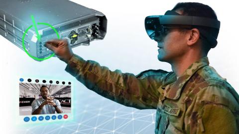
CACI Q&A With Manager of AI Research & Development Brian No
How Deep Learning Helps Speed Full-Motion Video Analysis
In a period of ten months, CACI’s team of Artificial Intelligence Deep Learning experts advanced its geospatial imagery analysis tool from “proof-of-concept” to demonstrating that tool within the operational environment for CACI’s customers. And soon, AI software developed by CACI will be able to analyze full-motion video streams and not only identify objects within the scene, but also persistently track the objects as they enter and exit the field of view of the sensor. CACI experts invent innovations like these in the rapidly evolving field of AI for national security customers to execute their critical missions.
In the interview below, CACI Manager of AI Research & Development Brian No discusses how CACI AI and Deep-Learning expertise and technology vastly speed imagery analysis and Full-Motion Video.
If you wish to schedule an interview with Brian, please contact CACI Corporate Communications at [email protected].
How is CACI using AI to revolutionize imagery analysis?
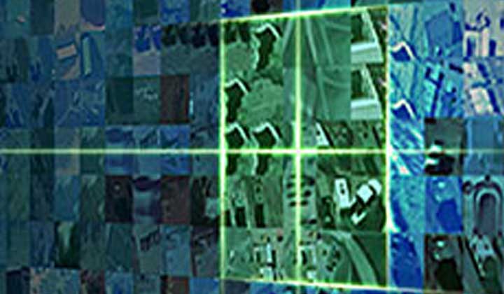
CACI’s AI-based technologies make it possible for a geospatial-intelligence analyst to process, exploit, and disseminate satellite imagery in minutes, when it used to take hours. That’s the power of CACI’s neural network and the power of AI: we can compress the time it takes to process satellite imagery exponentially compared to what a human can do today.
CACI’s FeatureTrace® uses Deep Learning to automate the collection of features such as roads, buildings, and lakes, contained within satellite imagery. Our software breaks down an image into bite size pieces for processing by the neural network. The output is a fully processed image with all the features identified with up to 97 percent accuracy.
Once this process is complete, an analyst quality checks the results. FeatureTrace significantly reduces the amount of time required to generate a finished image.
Why is the post-processing stage of imagery analysis so important?
There are other software tools that identify geographic features; however, our post-processing techniques is CACI’s “secret sauce”: FeatureTrace refines the neural network’s output to make the image much crisper and formatted in a way that an analyst can immediately use that image in any geospatial software tool of their choice.
How is CACI applying AI and Deep-Learning to analyzing full-motion video?
Our AI and Deep Learning experts have developed the capability to detect and persistently track objects within a full-motion video stream using CACI’s unique neural network. And while other companies offer basic object detection capability, only CACI’s software and techniques can track an object persistently. If an object leaves and re-enters the field-of-view of the sensor, our neural network model will automatically detect the object and provide the same unique ID to that object.
That was a tough nut to crack, but we have a great team that worked hard in developing the capability by leveraging state-of-the-art techniques and the latest technologies to apply AI to full-motion video analysis.
What are some examples of the next innovations we can expect as CACI continues to apply AI and Deep-Learning to imagery analysis?
For FeatureTrace, we’ll focus on collecting other features beyond just roads and buildings. We’ll start looking at extracting different features, such as hydrography, waterways, and powerlines. We’ll also improve the attribution of the features as well using Deep-Learning.
How Deep Learning Helps Speed Full-Motion Video Analysis